mercredi 29 juillet 2015

Golden Software Voxler

Golden Software Voxler, Create powerful, fast, customized 3D images and 3D models of your geologic data and point cloud data with Voxler 3. Easily import and combine data in a multitude of file formats to create stunning 3D models that visualize the relationships across your data set. This robust, yet user-friendly application gives you the power to display your data in a variety of formats and colors, model wells and boreholes in 3D, map surfaces in full 3D, capture video animation of your moving model, and select from several image and data export options to create stunning project and graphics.
Download link:

Grapher 8

Grapher is the ultimate technical graphing package available. This easy-to-use, powerful, and dynamic program will have you creating publication-quality graphs in minutes! The superior, professional, impressive graphs will be wowing your audience every time they see your graphs.Rose Diagrams display degree, radian or grad data versus a radial axis. Like histograms, Rose Diagrams display statistical data, showing the number of occurrences of an event that fall within a specific angular region. Bins are fully customizable in rose diagrams.
 
Download link:

ZondRes2D - software for 2D resistivity and IP imaging

Software for the interpretation of geophysical data are widespread. Depending on the nature of the application, they encompass many different directions in geophysics. Many of these software are for seismic data interpretation. The ZOND software package is oriented mainly for near surface geophysics.
The package has been developing during the 21st century and includes applications for electric prospecting, seismic, magnetic and gravity surveys. The main focus is on DC and AC resisitivity methods however modules for seismic interpretation are planned for the near future.
Download link:

GSS Potent

Potent is a Windows application that provides a highly interactive framework for 3-D modelling of magnetic and gravity data.
This example uses one of Geosoft's Oasis montaj sample datasets. The top left window shows the entire TMI dataset as a grid. The bottom left window shows the subset of data around the two anomalies of interest. The top right window shows an ENE section across this region. The anomalies have been modelled as a dyke and a flat tabular structure. The blue crosses are the observed TMI field, and the red line is the calculated field due to the model. The bottom right window shows the calculated field due to the model as an image at the same colour stretch as the observed field.
Potent works in 3-D space. Observation points can have height and ground clearance associated with them. The bodies that constitute the model are all able to be translated and rotated in three dimensions.
The field due to the model is calculated at the true position of the observations, thereby incorporating elevation effects such as those due to topography or aircraft height.
 
Download link:

Golden Software Surfer 12

Surfer 12 has just been released!!! There are many new features in Surfer 12 that improve its functionality. Over the next few weeks, we will be posting blogs about the new features in Surfer 12.
Download link:

Golden Software Starter

Golden Software, Inc., the leading developer of affordable scientific graphics software announces the release of Starter, a powerful, user-friendly upgrade to Strater, a well log, borehole and cross section plotting software package for geoscientists. Strater enables users to quickly create professional well logs, cross sections and location maps from interval, depth, and well data.
Download link:

Global Mapper


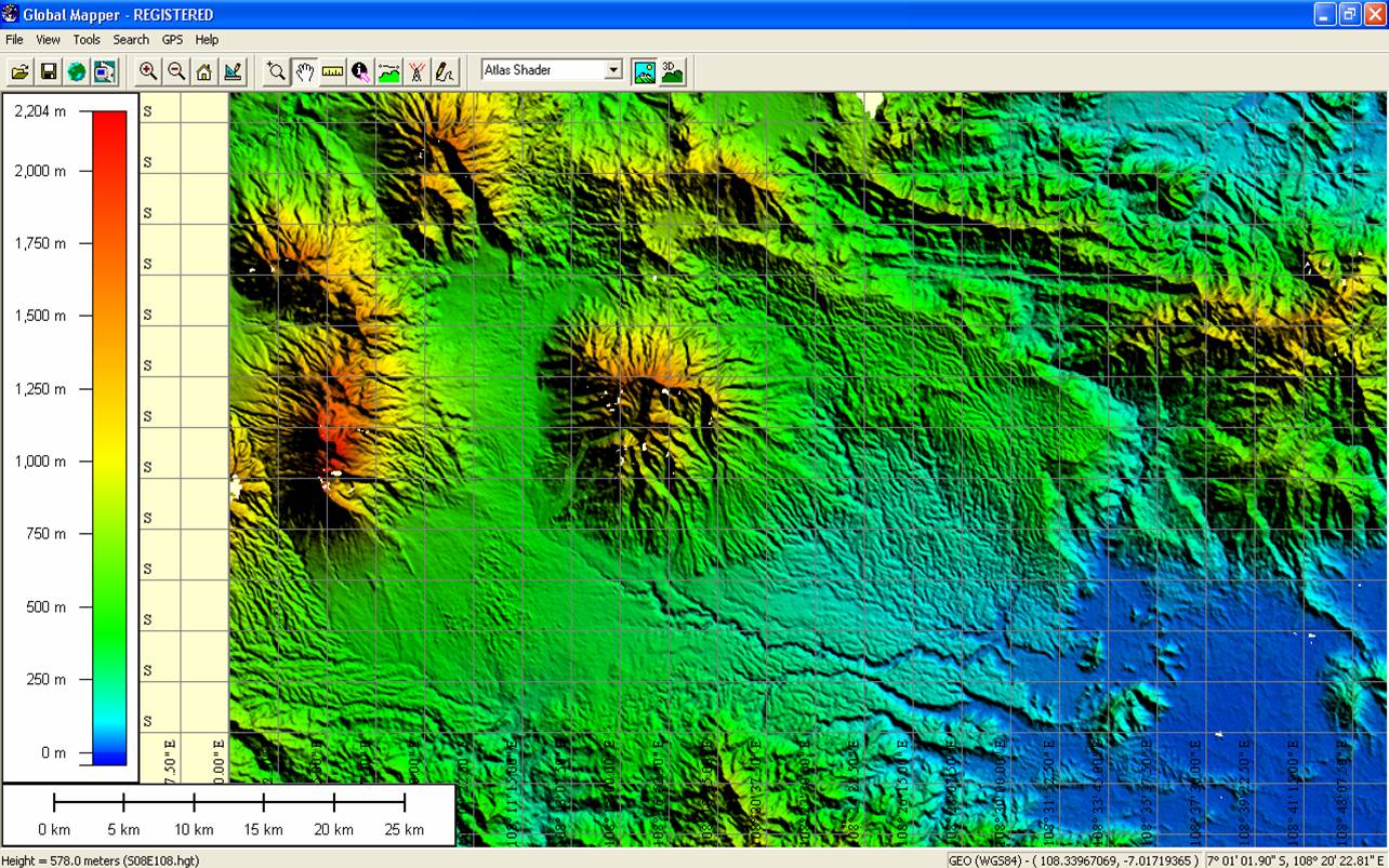
Global Mapper is an affordable and easy-to-use GIS application that offers access to an unparalleled variety of spatial datasets and provides just the right level of functionality to satisfy both experienced GIS professionals and beginning users. Equally well suited as a standalone spatial data management tool and as an integral component of an enterprise-wide GIS, Global Mapper is a must-have for anyone who deals with maps or spatial data.

Download link:

Geosoft Oasis montaj

Oasis montaj is ideally suited for today's multidisciplinary and collaborative exploration.
GEOSOFT

 Access all your data and a powerful set of mapping and analysis tools, within one dynamic, 3D exploration environment. Process, map, QA and interpret your ground and airborne survey geophysics, geochemistry and geology. - See more at: http://www.geosoft.com/products/oasis-montaj/overview#sthash.sgVVuemy.dpuf
Download link:


Field Geophysics (4th ed.) [J. Milsom & A. Eriksen, 2011]

The purpose of this book is to help anyone involved in small-scale geophysical
surveys. It is not a textbook in the traditional sense, in that it is designed
for use in the field and concerns itself with practical matters – with theory
taking second place. Where theory determines field practice, it is stated,
not developed or justified. For example, no attempt is made to explain why
four-electrode resistivity works where two-electrode surveys do not.
The book does not deal with marine, airborne or downhole geophysics,
nor with deep seismic reflection work. In part this is dictated by the space
available, but also by the fact that such surveys are usually carried out by
quite large field crews, at least some of whom, it is to be hoped, are both
experienced and willing to spread the benefit of that experience more widely.
Résultat de recherche d'images pour "Field Geophysics (4th ed.) [J. Milsom & A. Eriksen, 2011]"
Dounnloud link:

mardi 28 juillet 2015

Field Hydrogeology

As with the earlier editions, this book is a hands-on guide to field methods in
hydrogeology explaining what techniques are needed, how to carry them out
and why they are done that way. Advice is also provided on how to process
and interpret the data. A description of drilling and down-hole geophysics
methods has been included for the first time to assist those hydrogeologists
who are required to supervise the specialist contractors that normally undertake
this work, and also to interpret the resulting data. 
Résultat de recherche d'images pour "Field Hydrogeology, Third edition Rick Brassington"
Download link:

Groundwater_and_Wells

Groundwater_and_Wells
Download link:


The Messinian Salinity Crisis

This Atlas provides an overview of the most important characteristics of the offshore Messinian
Salinity Crisis (MSC) seismic markers. Throughout several study areas located in the Mediterranean
and Black Seas, this collective work aims at evidencing the most significant features (seismic facies,
geometry and extent) of Messinian surfaces and depositional units in the offshore domain. However,
this Atlas does not intend to provide a complete description of all what is known on the MSC and on
the geology of each study area. Accordingly, illustrations in the Atlas should be used for a global
description of the offshore imprints of the MSC at the scale of the Mediterranean and Black Seas, or
for local information or site-specific general interpretations. The listed references should be used for
more detailed or additional informations.
Download link:download link


INTERNATIONAL GLOSSARY OF HYDROLOGY GLOSSAIRE

This 3rd edition of the UNESCO-WMO International Glossary of Hydrology builds on
the pioneering efforts of the WMO Working Group on Terminology established in 1961 which
evolved into the joint WMO/UNESCO Panel on Terminology in 1967, the work launched in
the framework of International Hydrological Decade, as well as the publication of the first
edition in 1974 and second edition in 1992. The fruit of a longstanding partnership, this
edition was prepared by a Standing Committee on Terminology, comprising members
designated by UNESCO and the WMO.

Download link


Geographic calculator Geocal

  • Converts coordinate data files between commonly-used mapping systems.
  • Uses seven-parameter transformations.
  • Has user-definable parameters allowing deployment anywhere in the world on almost any spheroid or mapping system.
  • Includes a large number of predefined mapping systems and spheroids.
  • Includes Geocentric Datum of Australia.
  • Compares geodesy of the same point in two different mapping systems.
  • Displays geographic, geocentric and projection coordinates of three dimensional points in any defined Mapping System.
  • Displays point scale factor and grid convergence.
Download link


Redhaounia Belgacem 
Dr.

University of Tunis El Manar-Tunisia
 Water Researches and Technologies Center Borj-Cedria (CERTE) -Tunisia

Geology-hydro-Geophysics
Geo-Resources Laboratory-Water Researches and Technologies Center Borj-Cedria (CERTE), BP 273 Soliman 8020, Tunisia.

Mail: belgacem.redhaounia@yahoo.fr  
          belgacem.redhaounia@gmail.com

Mobile: +216 96 97 26 80
              +216 25 27 21 49


Géophysique


La Géo-physique, ou physique de la Terre a pour but d’étudier les propriétés physiques
du globe terrestre. Pour cela, le géophysicien se repère dans l’espace et le
temps. Les trois mots clefs qu’il a toujours à l’esprit sont : dynamique, structure et
échelles.
L’objectif principal de la géophysique est de déduire les propriétés physiques et
la constitution de la Terre (ou d’autres corps du système solaire), à partir des phénomènes
physiques qui leur sont associés, par exemple, le champ géomagnétique,

Download link:
http://adf.ly/1LWWCq

Field Geophysics (3rd ed.) [John Milsom] (Geo-Field Guide Series)

The purpose of this book is to help anyone involved in small-scale geophysicalsurveys. It is not a textbook in the traditional sense, in that it is designedfor use in the field and concerns itself with practical matters – with theorytaking second place. Where theory determines field practice, it is stated,not developed or justified. For example, no attempt is made to explain whyfour-electrode resistivity works where two-electrode surveys do not.

Download link:

http://adf.ly/1LWUvg

Carbonate_Reservoir_Characterization

This book is intended for the use of geologist, geophysists, petrophysists,
and engineers interested in building geologic models that can be converted
into realistic reservoir flow models of carbonate reservoirs. The first edition
of this book was focused on methods and approaches for constructing
improved carbonate reservoir models. In this second edition these methods
are enlarged based on research results since the first edition was published.
Download link :